
Hanging glaciers and ice avalanches: the Himalayan hazard without a lake
Why in news: A DRDO-funded study published on 28 October 2026 modelled ice avalanches from three hanging glaciers above Badrinath on the Alaknanda.
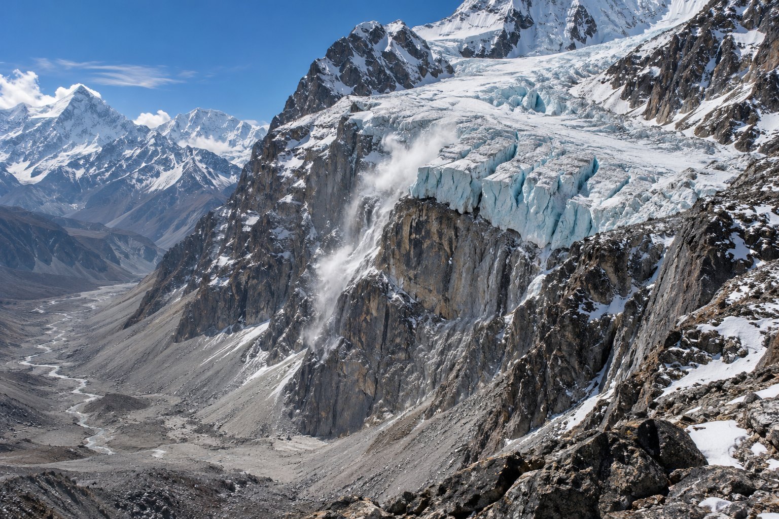
A hanging glacier is ice clinging to a steep mountainside or stopping abruptly at a rock cliff, cut off from the valley below. When it breaks away, it falls as an ice or rock-ice avalanche, and no glacial lake is needed. A DRDO-funded study of 28 October 2026 models such collapses above Badrinath.
Syllabus: Prelims · Geography; GS1 · Geophysical Phenomena; GS3 · Disaster Management
Why this matters for UPSC
GS1 geography and GS3 disaster management: Himalayan glacial hazards. Prelims can ask how an ice avalanche differs from a GLOF; Mains, how NDMA and DGRE reduce the risk.
In short
A hanging glacier is ice perched on a steep slope or cliff; when it breaks loose, it falls as an ice or rock-ice avalanche, a hazard needing no lake.
India maps its glacial lakes; hanging glaciers need the same inventory, and worst-case runout zones, not yatra demand, should decide where Himalayan towns grow.
Why it matters
A pilgrim at Badrinath, a shopkeeper on its slopes or a worker in a valley tunnel has little time once a hanging glacier gives way. Ice and debris move fast and far, so safety depends on where buildings, roads and power projects already stand. That makes land-use choices as important as alarms: a guesthouse built in an avalanche's path stays exposed whatever the forecast says. Chamoli showed the cost when hydropower sites sat below unstable ice and workers were trapped in tunnels. As warming loosens high-altitude ice, more Himalayan towns, shrines and dams face the same choice: keep new building out of the path, or watch the slopes closely and be ready to move people.
Prelims pointers
- The Defence Geoinformatics Research Establishment (DGRE), Chandigarh, prepares avalanche hazard maps and issues regular avalanche warnings to the Army and civilians in the snow-bound north-west Himalaya.
- DGRE's avalanche monitoring radar in North Sikkim, the first in India by DGRE's account, can detect an avalanche within three seconds of its trigger.
- NRSC, under ISRO, maps glacial lakes to judge GLOF risk; DGRE, under DRDO, forecasts avalanches and maps avalanche sites.
- NRSC's glacial lake atlases, made under the National Hydrology Project of the Ministry of Jal Shakti, cover the Indus, Ganga and Brahmaputra basins.
- NDMA's guidelines on the management of landslides and snow avalanches (June 2009) advise States on response, preparedness, mitigation and early warning for avalanches.
- The Common Alerting Protocol based Integrated Alert System sends geo-targeted disaster alerts by linking alerting agencies such as the India Meteorological Department, the Central Water Commission and DGRE.
- The Indian Himalayan Region lies in Seismic Zones IV and V; earthquakes, with avalanches and falling boulders, leave its glacial lakes open to breaches, NDMA notes.
- The Rishiganga and the Dhauli Ganga, site of NTPC's Tapovan project, are Alaknanda-system rivers; Chamoli district also holds Hemkund Sahib and the Valley of Flowers.
Practise a UPSC-style question
With reference to glacial hazards in the Himalaya, consider the following statements:
1. A glacial lake outburst flood is the sudden release of water held back by a glacier or a moraine.
2. An avalanche from a hanging glacier falling into a lake can trigger a glacial lake outburst flood.
3. Thawing of permafrost on steep mountain slopes reduces the likelihood of rockfalls and large rock avalanches.
Which of the statements given above is/are correct?
- (a) 1 and 2 only
- (b) 2 and 3 only
- (c) 1 and 3 only
- (d) 1, 2 and 3
Show the answer
Answer: (a) 1 and 2 only
Answer: (a) 1 and 2 only. NDMA's 2020 guidelines support statements 1 and 2; statement 3 turns their warning around.
Statement 1: correct. NDMA's GLOF guidelines (2020) define a GLOF as the sudden release of water dammed by a glacier or a moraine.
Statement 2: correct. The same guidelines list avalanche displacement waves from hanging glaciers among the triggers of a lake outburst.
Statement 3: incorrect. NDMA says thawing permafrost on steep slopes can increase the likelihood of rockfalls and large rock avalanches.
Eliminate: Statement 3 reverses the effect of thawing permafrost, so every option that keeps 3 goes. Out: (b), (c), (d).
Trap: Reversed direction. Statement 3 keeps the right cause, thawing permafrost, but turns its effect from raising the hazard to lowering it.
Remember: A GLOF needs a dammed lake; a hanging-glacier avalanche can be one of its triggers.
More Explainers
- Crypto in Indian law: virtual digital assets, tax and PMLA cover Economy
- The collegium system for appointing and transferring higher court judges Polity
- Protected Area, Restricted Area and Inner Line Permits Polity
- Scheduled Tribe seats in Assemblies: Article 332 and Goa's 2025 Act Polity
- Ballot papers and EVMs: where India still votes on paper Polity
- Gelephu Mindfulness City: Bhutan's special zone on the Assam border World & IR
- Nuclear fusion, the tokamak and India's role in ITER Sci-Tech
- Gilgit-Baltistan, CPEC and India's sovereignty objection World & IR
- India-Nepal electricity trade: how Nepal sells power to India World & IR
- Infant mortality and child malnutrition among Scheduled Tribes National
- Genocide Convention, 1948: the legal test and who can judge it World & IR
- Chola bronzes: lost-wax casting and Nataraja iconography National