
IMD forecasts Bay of Bengal cyclone heading for north Andhra, south Odisha
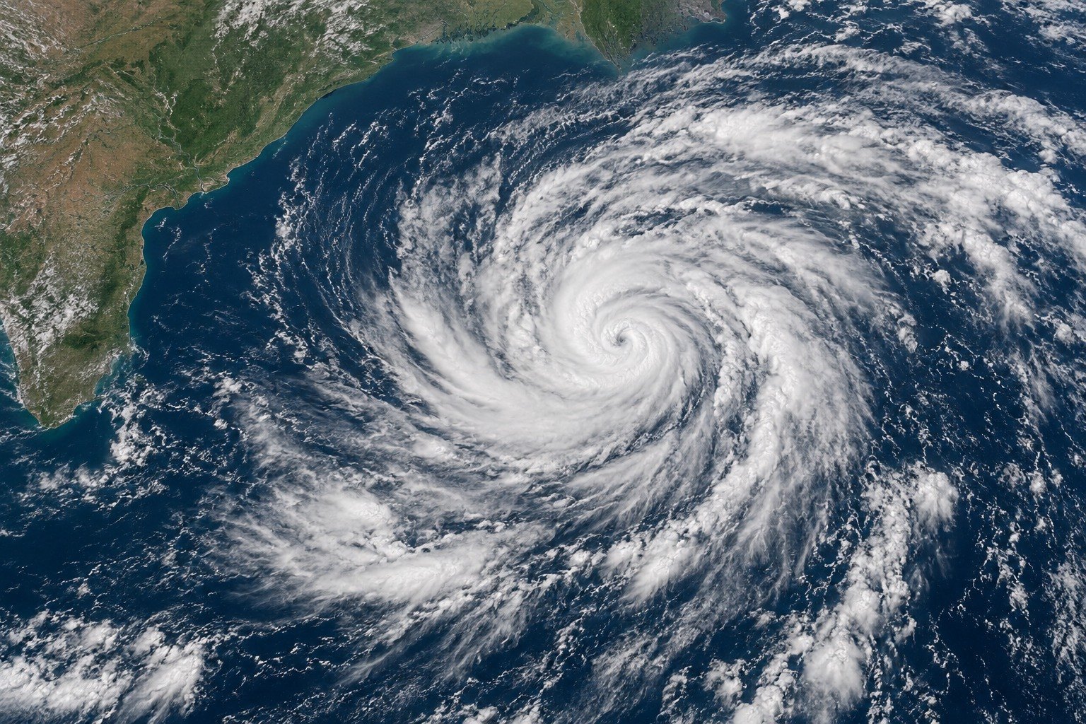
The India Meteorological Department (IMD) said a low pressure area formed over the eastcentral and adjoining southeast Bay of Bengal on 23 October 2026. It forecasts a depression on 24 October and a cyclonic storm by 26 October morning. The storm is then expected to move towards the north Andhra Pradesh and adjoining south Odisha coasts.
Syllabus: Prelims · Geography; GS1 · World Physical Geography; GS1 · Geophysical Phenomena
Why this matters for UPSC
GS1 geography (cyclones) and GS3 disaster management. Prelims can ask how a cyclone forms, IMD's intensity scale and the WMO/ESCAP Panel on Tropical Cyclones' naming rules; Mains, about cyclone early warning and preparedness.
Why it matters
Fishermen along the Andhra Pradesh and Odisha coasts lose working days first. IMD has asked boats at sea to come back and others to stay ashore, because rough seas build days before a storm reaches land. Farmers with standing paddy and vegetables face waterlogged fields, and towns may see flooded roads and slow traffic. A forecast made five days ahead gives district officials time to stock relief, ready shelters and move people from low-lying areas if needed. The larger question is how India turns an accurate warning into safety for the poorest coastal households, whose huts, boats and crops are the most exposed.
Prelims pointers
- India Meteorological Department: set up in 1875; works under the Ministry of Earth Sciences.
- RSMC New Delhi: one of six WMO-recognised tropical cyclone centres; also a Tropical Cyclone Advisory Centre issuing aviation advisories under ICAO guidelines.
- WMO/ESCAP Panel on Tropical Cyclones: 13 members, from Bangladesh and Myanmar to Qatar, Saudi Arabia, UAE and Yemen; India is a member.
- North Indian Ocean naming began in September 2004; the list adopted in April 2020 has 13 names from each member, each at most eight letters.
- IMD's scale by sustained winds: depression 17-27 knots, deep depression 28-33, cyclonic storm 34-47, severe 48-63, super cyclonic storm 120 and above.
- IMD's four-stage warning (since 1999): Pre-Cyclone Watch, Cyclone Alert, Cyclone Warning, Post-landfall Outlook.
- North Indian Ocean averages about five cyclones a year; the Bay of Bengal to Arabian Sea ratio is about 4:1; frequency peaks in November, then May.
- Cyclogenesis needs sea water of at least 26.5°C to a good depth; no cyclone forms within about 300 km of the equator.
Practise a UPSC-style question
With reference to the naming of tropical cyclones over the north Indian Ocean, consider the following statements:
1. The names are drawn from lists submitted by the member countries of the WMO/ESCAP Panel on Tropical Cyclones.
2. RSMC New Delhi names a system once its maximum sustained winds reach 34 knots or more.
3. A name once given to a cyclone over the north Indian Ocean is not used again for a later storm.
Which of the statements given above is/are correct?
- (a) 1 and 2 only
- (b) 2 and 3 only
- (c) 1 and 3 only
- (d) 1, 2 and 3
Show the answer
Answer: (d) 1, 2 and 3
Answer: (d) 1, 2 and 3. All three state the Panel's naming rules correctly.
Statement 1: correct. The list adopted in April 2020 has 13 names from each of the Panel's 13 member countries.
Statement 2: correct. A system is named when it becomes a cyclonic storm, with sustained winds of 34 knots (62 kmph) or more.
Statement 3: correct. North Indian Ocean names are never repeated; unlike Atlantic lists, they are not recycled.
Eliminate: Statement 1 is correct, so the code that leaves out 1 goes. Out: (b).
Eliminate: Statement 2 is correct too, so the code that leaves out 2 goes. Out: (c).
Eliminate: Statement 3 is correct as well, so the code without 3 goes. Out: (a).
Trap: Wrong scope. Atlantic hurricane lists are reused every six years; a student who carries that rule to the north Indian Ocean marks statement 3 wrong.
Remember: Named at 34 knots, from the Panel's list, and never reused.
More from the 24 October 2026 edition
- IAEA tells UN General Assembly nuclear power could triple by 2060 World & IR
- Haryana directs HERC under Section 108 to halt parallel power licence Polity
- NSO proposes PLFS redesign from 2027 to count platform workers Economy
- Karnataka HC: six guidelines curb mechanical FIRs, arrests over social-media posts Polity
- NMC withdraws 2023 medical education standards regulations, ends annual renewal Polity
- Orissa High Court: road pandals may stand if movement stays open Polity
- MHA tells Supreme Court of over 21,900 digital arrest complaints in 2026 National
- Jharkhand HC quashes Sentence Review Board's 'preordained' refusal of premature release Polity
- Allahabad HC: POCSO compensation cannot be refused for lack of injury Polity
- MoRTH draft proposes mandatory emergency braking (AEBS) in cars from 2030 National
- Kerala HC: State liable for wild-animal attacks despite not owning animals Environment
- Supreme Court: public property may be re-auctioned before a contract binds Polity