
Forest-loss dispute in Udanti Sitanadi tests conservation and community rights
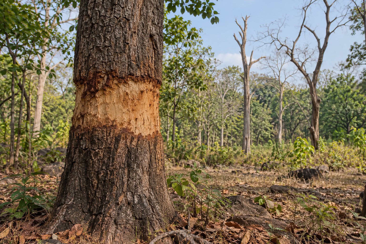
Forest officials of Chhattisgarh's Udanti Sitanadi Tiger Reserve estimate that over 2,500 trees, mostly sal, bija and tendu, have been girdled in Karka, an area vacated in the 1980s for the Sondhur dam. Officials say encroachment grew from 22 hectares in 2016 to over 30 hectares in 2026. About 32 families say they were never compensated.
Syllabus: Prelims · Environment & Ecology; GS2 · Welfare of Vulnerable Sections; GS3 · Environment & Conservation
Why it matters
The case connects forest degradation with wildlife connectivity, administrative capacity and community forest-resource rights. Officials warn that damage to this landscape can increase human-wildlife conflict, while the compensation dispute shows why conservation enforcement needs a fair account of relocation and recognised rights. For UPSC, satellite and drone mapping illustrate how geospatial evidence can support field investigation. The reported tree count remains an estimate, and a registered offence report does not establish guilt. Staff shortages and the distinction between allegations, measurement and adjudication are central to the governance problem.
Prelims pointers
- Girdling: removing portions of a tree's bark to cut off its nutrient supply, which eventually kills the tree.
- Community forest resource area: common forest land a community has traditionally protected and conserved for sustainable use.
- Community Forest Resource Rights recognise a community's right to protect, regenerate, conserve or manage the community forest resource.
- Karka lies in the catchment of the Sondhur dam, within the erstwhile Sitanadi Sanctuary.
- Encroachment is being mapped by GPS and DGPS-enabled drones, to be compared with ISRO satellite imagery.
Practise a UPSC-style question
Consider the following statements about satellite evidence from Karka:
1. ISRO images showed crop fields near the dam's submerged area in 2006.
2. Imagery shows sparse forest in 2016 and dense forest in 2017.
Which of the statements given above is/are correct?
- (a) 1 only
- (b) 2 only
- (c) Both 1 and 2
- (d) Neither 1 nor 2
Show the answer
Answer: (a) 1 only
Crop fields appeared in 2006 imagery. Statement 2 is reversed: 2016 imagery shows dense forest and 2017 a stark loss, as girdled trees dried and died.
More from the 3 October 2026 edition
- Centre allows final decisions on pending post-facto environmental clearance cases Environment
- Law Ministry notifies rules for National Tribunals Commission and tribunal selection Polity
- Strategic petroleum reserves: G7 to release 100 million barrels through IEA Economy
- Tigress T138 released into Bengal's Buxa Tiger Reserve Environment
- Split SC Bench sends Election Commissioners law challenge to CJI Polity
- Jal Arpan: over 1,850 panchayats take charge of rural water schemes National
- MHA orders 48-hour reporting of cases against AGMUT officers Polity
- Allahabad HC rules hookah service barred in designated smoking areas Polity
- Allahabad HC opens noise-enforcement PIL, seeks accountability Environment
- INS Sahyadri and Kulish conclude AIME 2026 in the Philippines Defence